tracking the tropics —
Ana’s formation is part of a trend toward earlier storms in the Atlantic.
Eric Berger
–

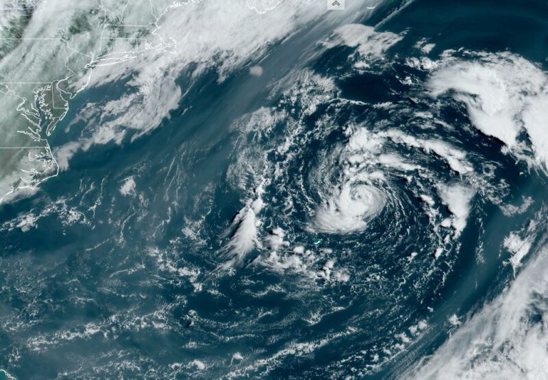
Enlarge / Subtropical Ana forms in the Atlantic on Saturday morning.
NOAA
The National Hurricane Center said that a low-pressure system to the northwest of Bermuda had become sufficiently organized on Saturday morning to become a subtropical storm. It will be named Ana.
Although Ana has some tropical characteristics, it is considered “subtropical” because it is associated with a low-pressure system in the upper atmosphere, and its maximum winds are located farther from its center. Ana should not strengthen significantly above its current maximum of 45 mph winds and should dissipate by early next week as it moves away from Bermuda.
Despite its relative weakness, Ana is notable for a couple of reasons. This is the seventh consecutive year, dating to 2015, in which a “named” storm has formed in the Atlantic basin—which includes the northern Atlantic Ocean, Caribbean Sea, and Gulf of Mexico—before June 1. The beginning of June traditionally marks the official start of the Atlantic hurricane season.
Due to this trend toward earlier storms, which is at least partly attributable to climate change and the Atlantic Ocean warming earlier, the US government’s National Hurricane Center has considered moving the start date of the season to May 15. However, in something of a compromise, the agency decided to begin forecasting storms earlier but not declare an earlier official start.
“To provide more consistent information on the potential for late May and early June systems,” the agency said, it would begin to provide tropical weather outlooks four times daily, beginning on May 15.
Those outlooks have been needed this year. In addition to Ana, forecasters tracked another disturbance on Friday and early Saturday in the Gulf of Mexico that showed some signs of organizing. However, it moved inland, into the Central Texas coast, early on Saturday before attaining status as a tropical depression.
The two areas highlighted by the NHC for possible tropical/subtropical development are outside the region that has typically seen pre-season storms. pic.twitter.com/uZUY1lLYwj
— Sam Lillo (@splillo) May 21, 2021
One surprising thing about Ana and this Gulf system is that they both developed circulations outside of the area where May storms have historically formed. This suggests the possibility that, in addition to more named storms forming earlier in the season, the area in which they may potentially form is also expanding.
Historically, the presence of named storms in May has not necessarily presaged an overly busy Atlantic hurricane season. However, this year forecasters at NOAA and elsewhere are nonetheless anticipating a busier than normal season due to the lack of an El Niño, which tends to dampen Atlantic activity, as well as warmer than normal Atlantic sea surface temperatures. NOAA predicted 13 to 20 named storms will form this year. One is already in the books.

