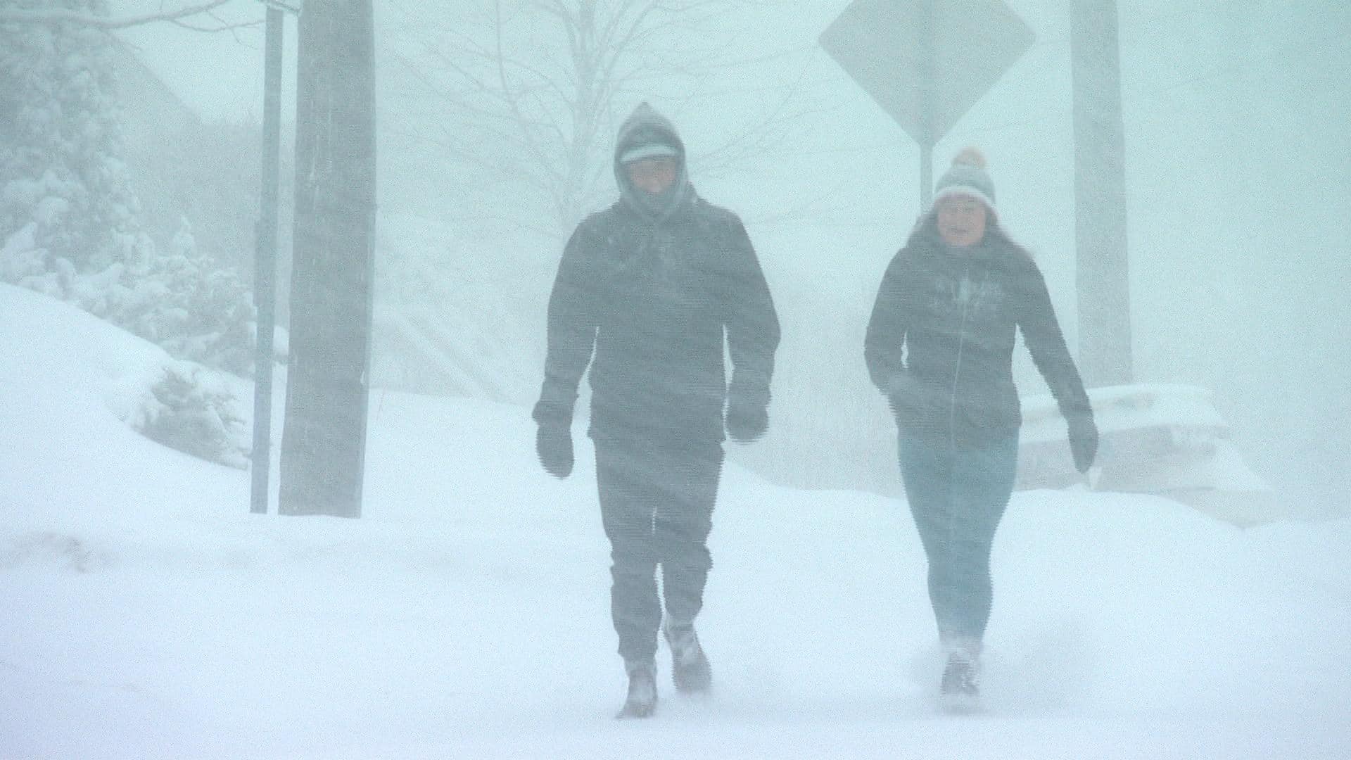
The Maritimes are getting hit with a storm system that’s bringing snow and high winds to the region, followed by rain to many parts of Nova Scotia, New Brunswick and Prince Edward Island.

High winds and heavy snow are hitting much of the Maritimes, forcing schools to close. The snow in Nova Scotia is changing to ice pellets and then cold, driving rain. A day to hunker down. 2:05
A system of snow, rain and high winds struck the Maritimes on Tuesday, a storm that’s expected to continue over parts of Nova Scotia, New Brunswick and Prince Edward Island overnight.
Thousands of homes and businesses were without power Tuesday afternoon, though crews had restored electricity to much of the region by 5 p.m. AT.
Outages peaked in Nova Scotia at about 4 p.m., with more than 12,000 customers of Nova Scotia Power without electricity.
“The damage started in the west early this morning in the Shelburne area,” said Lia MacDonald, vice-president of transmission, distribution and delivery with Nova Scotia Power.
“And then the storm tracked across into the [Halifax] metro region, which is where we saw most of our outages earlier this afternoon, although the majority of those have been restored.”

MacDonald said the province had a total of 42,000 outages through the day, and she expected more as the storm hits Cape Breton on Tuesday evening.
As of 9 p.m. AT, more than 4,000 Nova Scotia Power customers were without electricity — most of whom are in the Victoria and Inverness counties of Cape Breton.
Expected restoration times vary, but most customers should expect to have their power restored by late Wednesday, according to Nova Scotia Power’s website.
- Full list of Nova Scotia cancellations
Most of the outages were caused by high winds along the coast. The Halifax Dockyard reported gusts of up to 96 km/h, and in Cape Breton, Grand Etang reported 183 km/h.
The weather also forced almost all schools across the three provinces to close on Tuesday morning. Several universities and Nova Scotia Community College campuses also shut down for the day.
MacDonald said 300 field technicians are working on the damage Tuesday evening. Contractors from New Brunswick have been brought into Nova Scotia to help, but they must isolate in hotels while they await mandatory COVID-19 testing.
The high winds could also delay repairs.
“It really does come down to wind, and when that is over 80 km/h, it’s not considered safe for our crews. They will stand down until it is safe to go back out and continue restoring power,” said Nova Scotia Power spokesperson Jacqueline Foster.

Halifax Regional Police asked people to drive with extreme caution during the storm. Drivers were asked to allow extra time for their commute so they won’t have to rush, to clean all snow off their vehicles — including the roof — and to turn on their headlights.
A transport truck had gone off the road on Highway 101 in the Hantsport area, according to Nova Scotia’s Department of Transportation. There’s no word on whether anyone was injured in the crash.
Much of Nova Scotia also received about 10 to 15 centimetres of snow early Tuesday.
Environment Canada has issued wind warnings for much of Nova Scotia — they are expected to continue overnight — and a rainfall warning for almost the entire province. The rain started first in the southwest of the province late Tuesday morning and arrived in the rest of the province in the afternoon into evening. Cape Breton is not expected to get rain until Tuesday night, forecasters say.
Anywhere from 25 to 80 millimetres of rain could fall by Tuesday night and, according to CBC meteorologist Ryan Snoddon, could become heavy. There’s also a risk of a thunderstorm for the region.
=Updated Maritimes Timeline=
Rain at times heavy tapers to scattered showers thru this evening & overnight across the southern Maritimes.
Snow & ice mix with/to rain over northern NB.
Winds ease from SW to NE.
M. cloudy, a few showers (NB flurries) on Wed aft. #nbstorm #nsstorm pic.twitter.com/1A9WF1G5ij
—@ryansnoddon
New Brunswick and P.E.I.
New Brunswick was expected to receive between 15 and 45 centimetres of snow, depending on the area, according to Environment Canada. Northern parts of the province were expected to get up to 45 centimetres throughout the day Tuesday.
- Full list of New Brunswick cancellations
The snow started early in the afternoon, before switching to rain mixed with ice pellets. Environment Canada said there is also a risk of freezing rain overnight into Wednesday morning. Snow and ice pellets are expected to taper off Wednesday afternoon.

As of 9 p.m., NB Power had restored power to about 800 customers who had lost electricity late Tuesday afternoon.
Marc Belliveau, a spokesperson for NB Power, said 72 crews were on standby to repair power outages. The utility also hired 25 contract crews.
On Prince Edward Island, Environment Canada issued a special weather statement for Kings and Queens counties.
“Whether we’re under the warning or not, it’s going to be a really messy system, really hard to get around in today. If you can stay home and just bunker down, today’s the day to do it,” said CBC meteorologist Tina Simpkin.
- Full list of P.E.I. cancellations
The University of Prince Edward Island and Holland College closed their campuses. Many government offices — federal, provincial and municipal — delayed opening.
Winds have been strong across the province, with gusts up to 70 km/h Tuesday afternoon that are expected to continue into the early morning.
Confederation Bridge warned of traffic restrictions starting Tuesday morning and potentially continuing into Wednesday morning.
