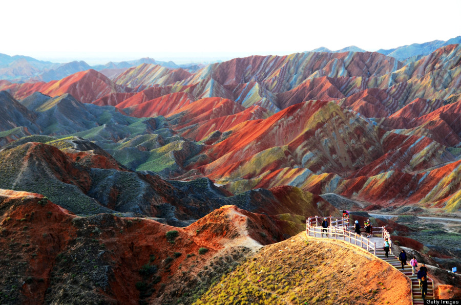
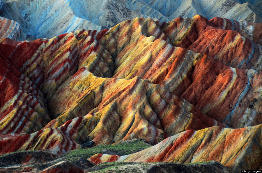
Zhangye Danxia Landform is majestic and imposing, together with the unusual shapes and the gorgeous colors, making people are stunned by the creation of the nature. The beauty of Zhangye Danxi is not because it is odd, dangerous but also its color. In a circumference of more than 10 square kilometers of range, there are bright colors as red, yellow, orange, green, white, graphite, gray, gray can be seen everywhere, decorating the numerous trenches and hills colorfully. Zhangye Danxia landform’s bedding staggered lines, colorful tunes and dazzling splendor drawing form a colorful fairy tale world.
Location
Zhangye Danxia landform is mainly divided into two the north and south groups echoing each other. The north group is located at the north part of Zhangye City on the Heli Mountains, about 25 km away from the downtown. The north mountain form is low and flat, mainly in red and white and red ocher tones. South group takes the Sunan Yugurs Autonomous County as the center, away from the Zhangye urban area of about 40 to 50 km. South Mountains landform is relatively steep, and is amazing for its bedding stretches, clear texture, and colors. Zhangye Danxia Land form is concentrated in Linze and Sunan County, covering an area of over 300 square kilometers. It is one of the largest and best China Danxia landform with richest landscape modeling.
Ancient Zhangye City
Ancient Zhangye, originally called Ganzhou, was an important city on the ancient Silk Road and one of four counties in Hexi Corridor. It is the political, economic, cultural and diplomatic center in the northwest China in each dynasty. Zhang Qian, Ban Chao, Fa Xian, Tang Xuanzang were all accessed via Zhangye to the western regions. Emperor Shuiyang used to hold a “World Exposition” in Zhangye with 27 kings of the western regions. Marco Polo had been obsessed with this land and stayed here for a year.
Geomorphological features
The Danxia landform here was developed in about 200 million years ago before the Jurassic to Tertiary. Zhangye Qilian Danxia is mainly constituted by red gravel, sandstone and mudstone, with the imprint of a clear arid, semi-arid climate. It is a natural scenic spot perfect combining the sheer cliffs and steep mountains, strange, dangerous, beautiful of peaks pillars and the color of Xinjiang’s Colorful City.
The landscape is appraised and elected by Chinese National Geography in”Beauty China” campaign as the No. 6 “China’s most beautiful seven Danxia” . Comparing with the Yadan landform in Dunhuang “Ghost City”, Zhangye Danxi Landform is broader, more magnificent, and spectacular.
Historical Site
Zhangye has a wealth of historical sites, such as the Yuezhi Blackwater Country Ruins, the Great Wall Beacon Towers, the wooden pagoda of Sui Dynasty, the Buddhist temple of Xixa, the bell towerMing Dynasty and so on.
Yugurs
Yugurs of Gansu Province is one of three specific minority, concentrated settlements in Sunan Yugurs Autonomous County. Not it has a population of 10,000. They all believe in Tibetan Buddhism and primitive religion. Yugurs are typical steppe nomads, living in tents, wear robes , eat beef and mutton and drinking butter tea and barley wine. They wear gorgeous and colorful costumes, cheerful and lively dancing.
Yugurs people area hospitable and honest. Yugurs living customs and language have some similarities with that of the Hungarian people.
es, we had a hard time believing that this insane mountain formation was actually real, because we haven’t fallen down the rabbit hole. But, believe it or not, this technicolor range actually exists.
Story continues below


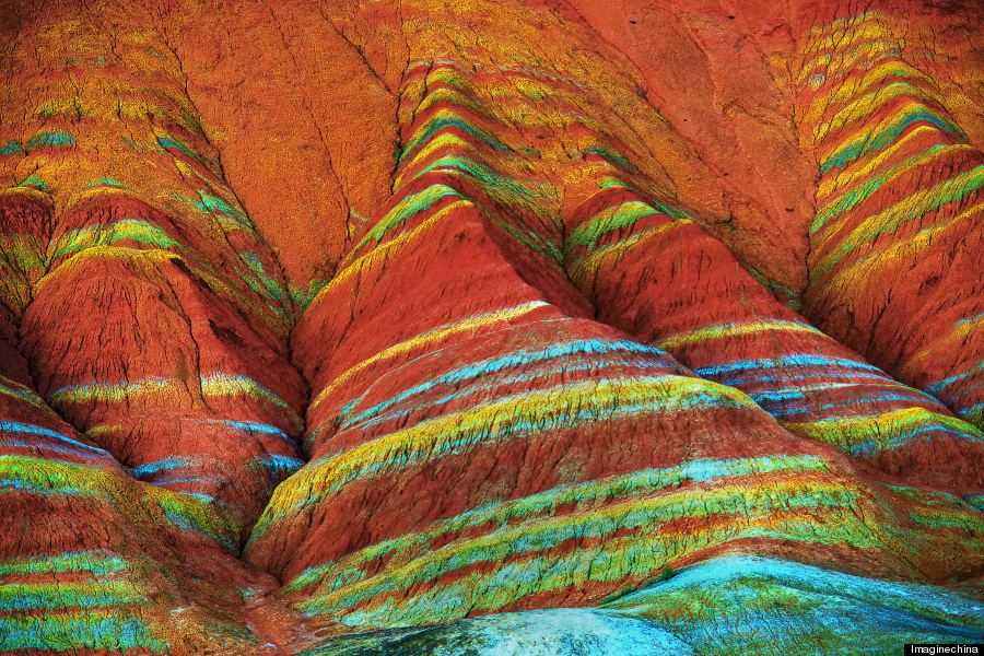
The mountains are part of the Zhangye Danxia Landform Geological Park in China. Layers of different colored sandstone and minerals were pressed together over 24 million years and then buckled up by tectonic plates, according to the Telegraph.
Here’s a photo showing some detail of the rich “layer cake” action going on.

There’s a similar formation in British Columbia called the Rainbow Range formed from a mixture of volcanic rock and various minerals.
While the photos are certainly incredible, there could be some slight photo manipulation going on to make the colors pop a bit more than they would naturally. This Flickr photo could be a more accurate representation, but still, the mountains are amazing.
The formations were shaped into the flowing valleys after thousands of years of rain and wind, and the region has been listed as a UNESCO World Heritage site since 2010.


Take a look at some more incredible photos of the range below, and tweet us @HuffPostGreen if you have any of your own!


